Glider observatory
The C-PROOF glider missions are designed to better understand the structure of ocean properties offshore of British Columbia’s coast, and how those properties are mixed between coastal water and offshore water.
Currently, we maintain three lines as regularly as funding, time, and equipment will allow. Line P is a historic line that goes from coastal BC to the middle of the Alaska Gyre at “Station P” (50 N, 145 W). The Calvert Line runs from Calvert Island in Queen Charlotte Sound offshore, sometimes as far west as Station P16. The most recently added line is the Southern Line, which goes offshore from Tofino, approximately perpendicular to the coast.
There are a number of other missions that have taken place, including a partnership with Council of Haida Nation and Gwaii Haanas, including measurements in the Gwaii Haanas National Marine Conservation Area Reserve and Haida Heritage Site as well as other regions of cultural significance. We have also had a few missions that run along the coast, either for logistical reasons, or in order to follow the SWOT altimeter line.
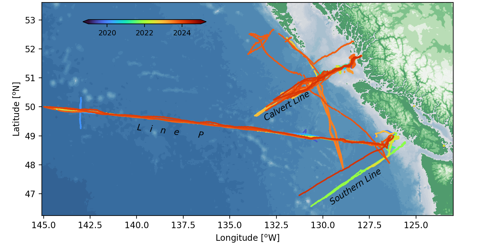
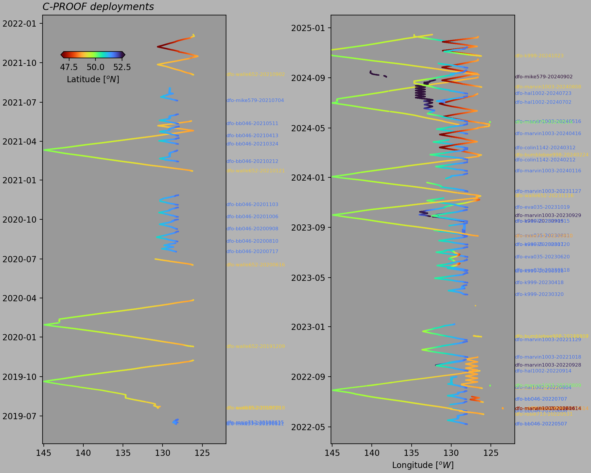
Deployments started in 2019, but really ramped up in late 2022 as most of the glider fleet was acquired. Since that time, we have often had three gliders in the water at all times.
Glider line vocabulary
Download cproof_line_vocab.yml to see the full list of glider lines and their waypoints.
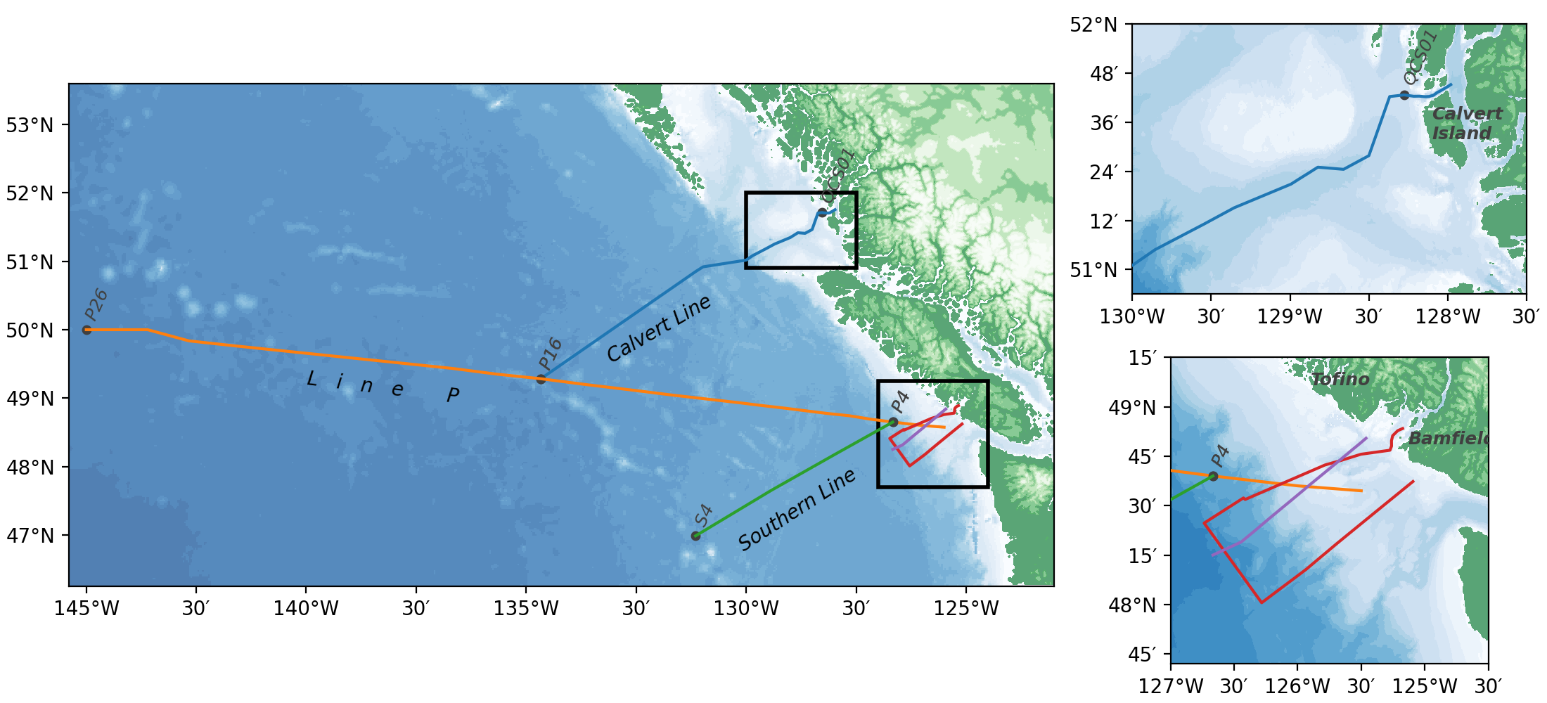
Calvert
Calvert Island Line: Runs from Fitz Hugh Sound, down Hakai Pass, across Queen Charlotte Sound, and out to P16.
| Station | Latitude | Longitude |
|---|---|---|
| FZH08 | 51.7537 | -127.9805 |
| HP01 | 51.7413 | -128.011 |
| HP02 | 51.7295 | -128.0428 |
| HP03 | 51.721 | -128.068 |
| HP04 | 51.7102 | -128.0905 |
| HP05 | 51.7053 | -128.1192 |
| HP08 | 51.7045 | -128.1452 |
| HP09 | 51.7067 | -128.181 |
| HP10 | 51.7062 | -128.2152 |
| QCS01 | 51.7117 | -128.2767 |
| CL02 | 51.705 | -128.368 |
| CL03 | 51.464 | -128.5 |
| CL04 | 51.4083 | -128.6605 |
| CL05 | 51.417 | -128.8237 |
| CL06 | 51.3935 | -128.8812 |
| CL07 | 51.3713 | -128.9367 |
| CL08 | 51.348 | -128.9937 |
| CL09 | 51.2515 | -129.3543 |
| CL10 | 51.1842 | -129.5478 |
| CL11 | 51.081 | -129.855 |
| CL12 | 51.0167 | -130.0 |
| CL13 | 50.9187 | -130.979 |
| CL14 | 50.8493 | -131.1492 |
| P16 | 49.2833 | -134.6667 |
LineP
Line P long-term oceangraphic line: Long-standing oceanographic line from mouth of St. of Juan de Fuca to Station Papa (P26).
| Station | Latitude | Longitude |
|---|---|---|
| P1 | 48.575 | -125.5 |
| P2 | 48.6 | -126.0 |
| P3 | 48.625 | -126.3333 |
| P4 | 48.65 | -126.6667 |
| P5 | 48.6917 | -127.1667 |
| P6 | 48.7433 | -127.6667 |
| P7 | 48.7767 | -128.1667 |
| P8 | 48.8167 | -128.6667 |
| P9 | 48.8567 | -129.1667 |
| P10 | 48.8933 | -129.6667 |
| P11 | 48.9333 | -130.1667 |
| P12 | 48.97 | -130.6667 |
| P13 | 49.0433 | -131.6667 |
| P14 | 49.1233 | -132.6667 |
| P15 | 49.2 | -133.6667 |
| P16 | 49.2833 | -134.6667 |
| P17 | 49.35 | -135.6667 |
| P18 | 49.4333 | -136.6667 |
| P19 | 49.5 | -137.6667 |
| P20 | 49.5667 | -138.6667 |
| P21 | 49.6333 | -139.6667 |
| P22 | 49.7 | -140.6667 |
| P23 | 49.7667 | -141.6667 |
| P24 | 49.8367 | -142.6667 |
| P25 | 50.0 | -143.605 |
| P26 | 50.0 | -145.0 |
Southern
Southern Line: Line from P4 to approximately 400 km offshore to the southeast.
| Station | Latitude | Longitude |
|---|---|---|
| P4 | 48.65 | -126.6667 |
| S2 | 48.1833 | -127.9667 |
| S3 | 47.65 | -129.4333 |
| S4 | 46.9867 | -131.15 |
Bamfield
Bamfield Line: Out of Bamfield, loop almost along the LC line, but a bit more due west, and return on LB line.
| Station | Latitude | Longitude |
|---|---|---|
| BMSC01 | 48.89 | -125.174333 |
| BMSC02 | 48.879 | -125.213167 |
| BMSC03 | 48.8535 | -125.253 |
| BMSC04 | 48.827833 | -125.262167 |
| BMSC05 | 48.800833 | -125.261667 |
| BMSC06 | 48.780167 | -125.274 |
| BBMSC07 | 48.759833 | -125.502333 |
| BMSC08 | 48.726833 | -125.667167 |
| BMSC09 | 48.7055 | -125.785167 |
| BMSC10 | 48.531167 | -126.412833 |
| BMSC11 | 48.538833 | -126.4265 |
| BMSC12 | 48.41158 | -126.73594 |
| LB16 | 48.0088 | -126.2833 |
| LB13 | 48.1767 | -125.9353 |
| LB10 | 48.3095 | -125.6892 |
| LB07 | 48.478 | -125.3683 |
| LB03 | 48.622 | -125.093 |
LC
LC Line: La Perouse LC line
| Station | Latitude | Longitude |
|---|---|---|
| LC01 | 48.8407 | -125.4622 |
| LC02 | 48.8113 | -125.5158 |
| LC03 | 48.7825 | -125.5707 |
| LC04 | 48.7238 | -125.68 |
| LC05 | 48.6657 | -125.79 |
| LC06 | 48.6077 | -125.9 |
| LC07 | 48.5493 | -126.0083 |
| LC08 | 48.4908 | -126.1183 |
| LC09 | 48.4323 | -126.2283 |
| LC10 | 48.3733 | -126.3367 |
| LC11 | 48.3158 | -126.445 |
| LC12 | 48.25 | -126.6667 |
LB
LB Line: La Perouse LB line
| Station | Latitude | Longitude |
|---|---|---|
| LB01 | 48.6733 | -124.9913 |
| LB02 | 48.65 | -125.04 |
| LB03 | 48.622 | -125.093 |
| LB04 | 48.5945 | -125.1453 |
| LB05 | 48.5667 | -125.2 |
| LB06 | 48.5363 | -125.2585 |
| LB07 | 48.478 | -125.3683 |
| LB08 | 48.4217 | -125.4775 |
| LB09 | 48.3667 | -125.58 |
| LB10 | 48.3095 | -125.6892 |
| LB11 | 48.2533 | -125.7958 |
| LB12 | 48.2153 | -125.865 |
| LB13 | 48.1767 | -125.9353 |
| LB14 | 48.1413 | -126.0 |
| LB15 | 48.0727 | -126.141 |
| LB16 | 48.0088 | -126.2833 |