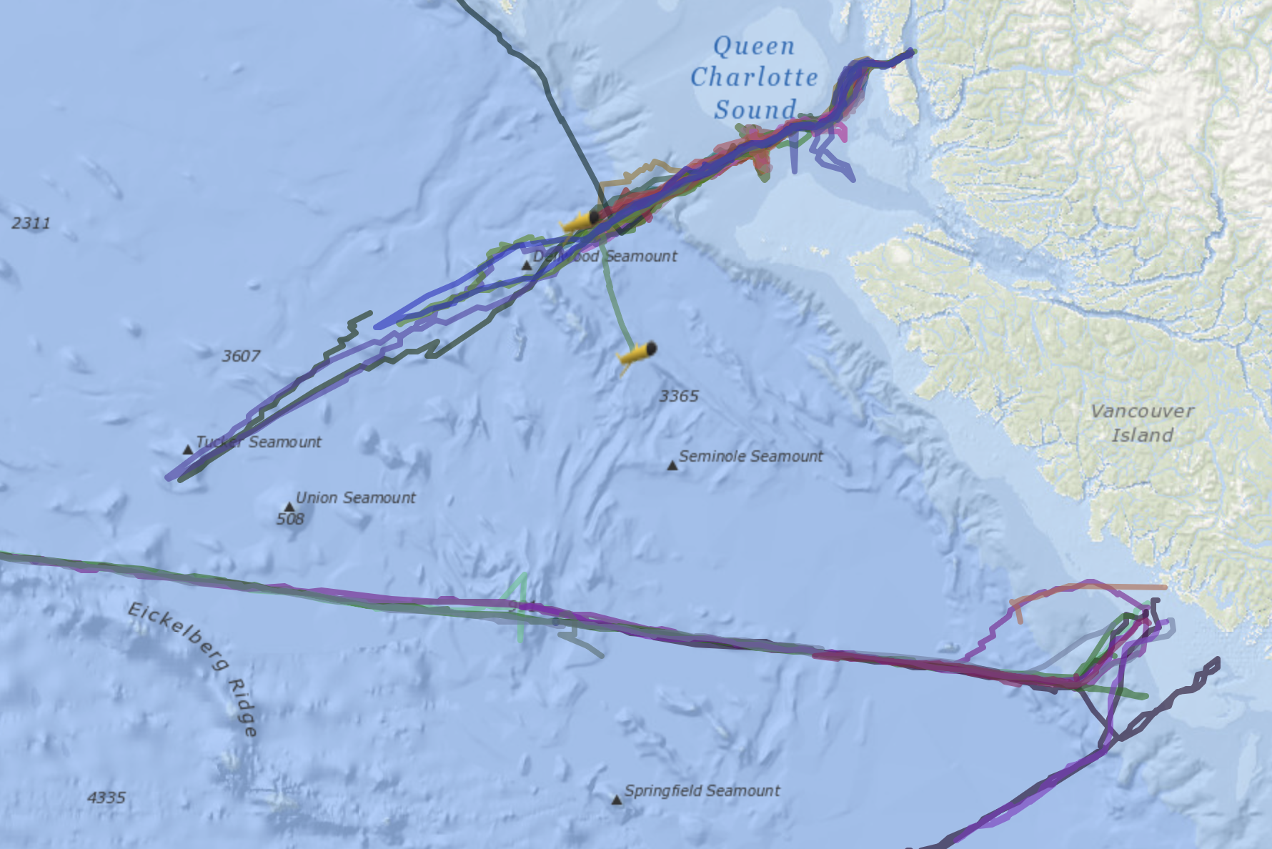
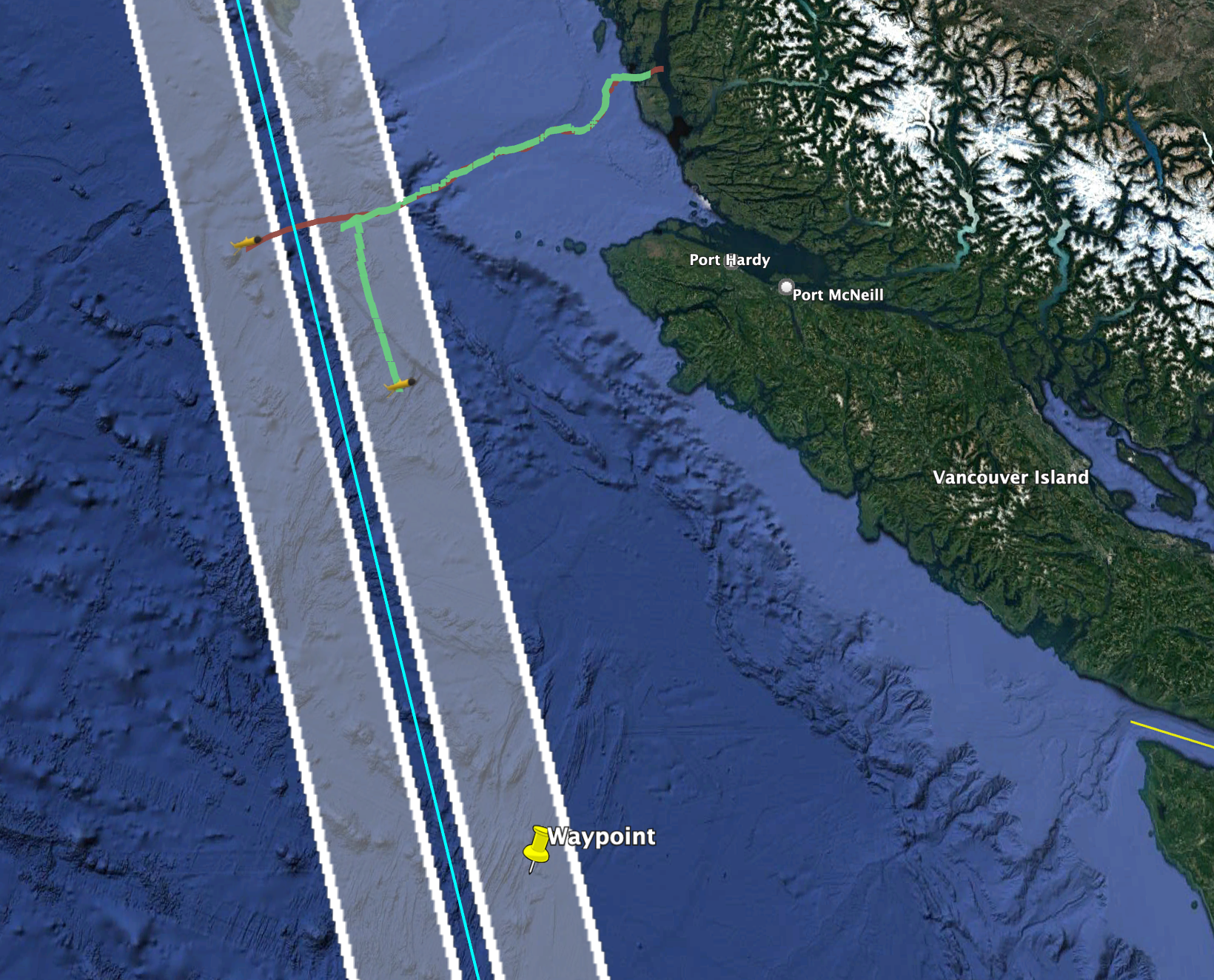
Typically our gliders run sections that cross isobaths and run perpendicular to the continental shelf. That lets us map the contrasting physical, chemical, and biological properties of the open ocean and coastal waters. Our recent mission with glider K9 started out that way; it was launched from Calvert Island by the oceanography crew at Hakai and drove down Goose Trough to the open ocean. But recently K9 has turned almost due South (green curve in image below). Where is K9 going?

Our goal with this mission is to have K9 follow the SWOT satellite track. SWOT stands for Surface Water and Ocean Topography, and is an exciting new satellite capable of returning kilometer scale sea-surface heights in the two white swaths shown below. Sea-surface height drives ocean currents, and on kilometer scales is a great indicator of sub-surface stirring by eddies and other instabilities. Until SWOT, satellites have been only been capable of resolving sea surface heights on a much larger scale. Canada is a partner in SWOT through the Canadian Space Agency

We are driving K9 along the SWOT track (green path above), because K9 measures the results of ocean stirring on temperature and salinity, and on similar scales to those measured by SWOT. Combining the two data types will be an exciting new way to investigate mesoscale and submesoscale flows in the ocean. Note that we also have glider Eva crossing the SWOT track, a few days behind K9 (red track above). Eva is turning around to head back to Calvert soon, but K9 will continue its mission for six more weeks, hopefully covering the track above three or four times before heading back for pickup closer to shore.
