C-PROOF deploys gliders in the Northeast Pacific ocean, with a particular emphasis on processes along the continental shelf, slope, and through the California Undercurrent system. As the program has built capacity we have tried to maintain these lines are regularly as we can. They are designed to compliment lines along North America (see the IOOS glider map along the west coast).
If you have suggestions for where the gliders should be deployed, feel free to contact us at cproof@uvic.ca.
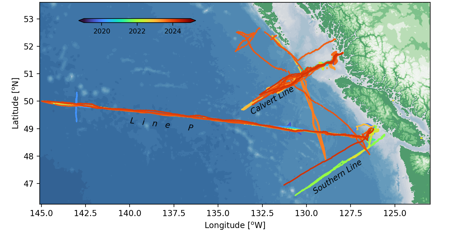
Line P
Line P is the longest ocean time series in the world. C-PROOF gliders have been deployed along Line P, usually with the goal of filling gaps between the regular ship surveys. Along the way we have eencountered Haida Eddies, and seen sudden changes in water masses along the continental slope.
Calvert Line
The Calvert Line is our most-occupied line, in partnership with Hakai Institute, we have been deploying gliders from Calvert Island on the east side of Queen Charlotte Sound since 2019. These glider sample from the fjord-like Fitz Hugh Sound, down Goose Trough, to past the shelf break. As the sampling has matured, we have started using longer range gliders to also get approximately 300 km offshore of the continental slope before making the return trip.
Southern Line
Our newest line, this is meant to be parallel to the Calvert Line and extending approximately 400 km offshore of the continental shelf break. It is designed to capture the water masses coming from the south, and to allow comparisons of signals like El Nino with with Calvert Line. We plan to occupy this with a section approximately every two weeks as often as we are able to.